Contents
Index
Batch LandXML to Join
This tool is designed to quickly assemble a parcel network by using a GIS parcel fabric updated from LandXML files.
The base framework can be input using Mapinfo, DXF or Shape files
The LandXML files have to be downloaded into a separate folder.
This tool can then replace GIS parcels in the job with data from the LandXML files
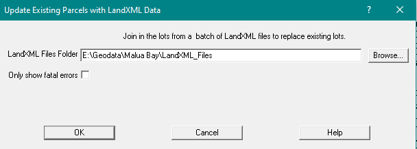
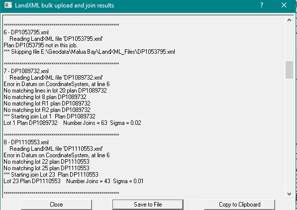
GeoCadastre will work through this folder and process every LandXML file in it.
Each LandXML file will be read and the data converted to an unjoined group of parcels for that particular plan.
Parcels in the group will be matched to parcels in the job to find corresponding corner points.
If there are sufficient matching points, the group will be joined in and the old parcels deleted.
If the LandXML plan does not exist in the job or if none of the LandXML parcels exist in the job, then the LandXML data for that plan is discarded.
If there are matching lots, but insufficient matching points, the group will remain unjoined and an "XX" will be placed in front of the plan name for the GIS parcels in that plan.
This will distinguish the different versions of the data for this plan and allow the user to manually join in the group and unjoin and delete the GIS parcels at a later time.
A report is generated and this can be saved to a file or posted to the clipboard.